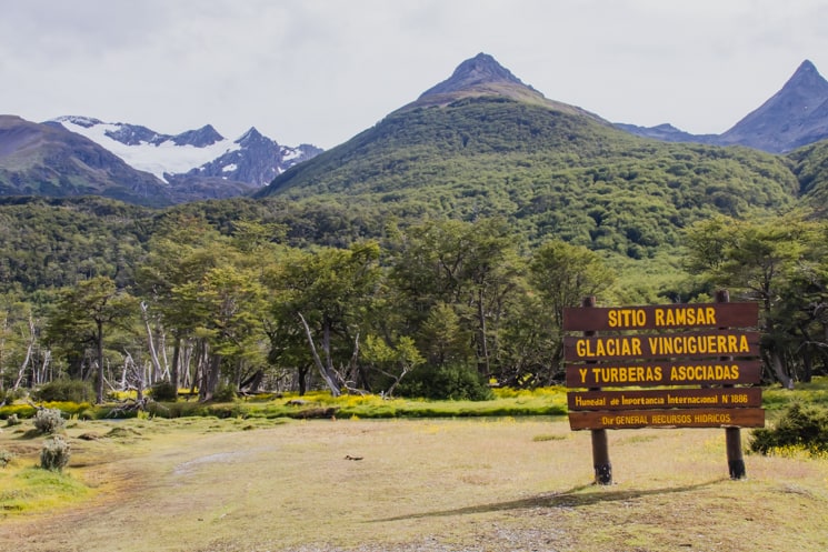
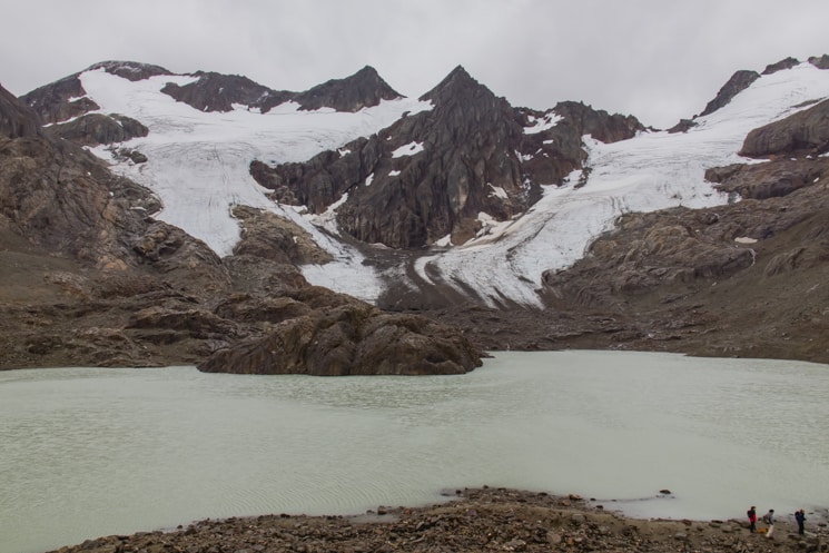
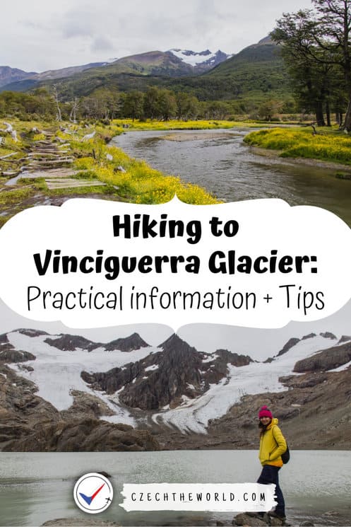
The Vinciguerra Glacier hike belongs among the most popular hikes in Ushuaia – the southernmost city in the world. The trail is an out-and-back route, and it takes you to the Laguna de los Témpanos and the Vinciguerra Glacier. The trailhead is located in Valle de Andorra, about 20 minutes by car from Ushuaia downtown.
Let’s have a look at the parameters and all the other information you need to know about the trail.
Vinciguerra Glacier Trail Parameters
- Time: 4 – 6 hours (time depends on how much time you want to spend by the lagoon and glacier itself)
- Distance: 11 kilometers / 7.1 miles (round trip)
- Elevation: 600 meters / 1970 feet of elevation gain
- Route: GPX of Vinciguerra Glacier trail
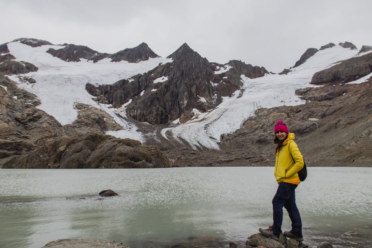
- Interesting fact: The Vinciguerra Glacier was named by the Italian expeditionary Giácomo Bove in memory of the zoologist who accompanied him on a scientific expedition to Tierra del Fuego in 1882.
Vinciguerra Glacier Hike Description
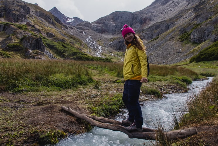
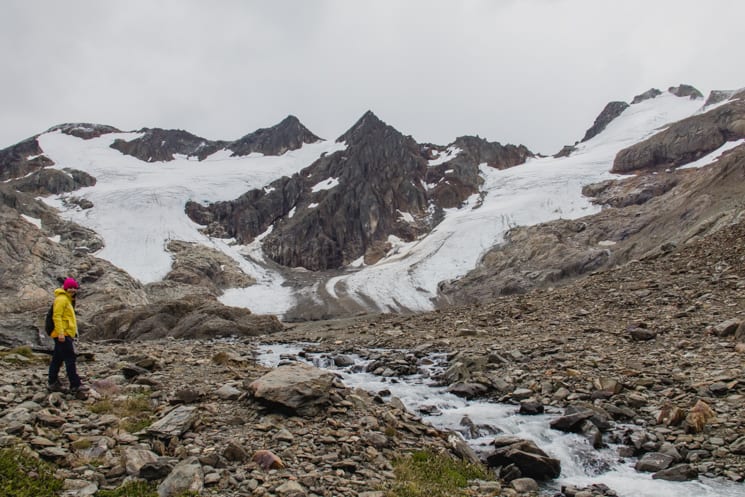
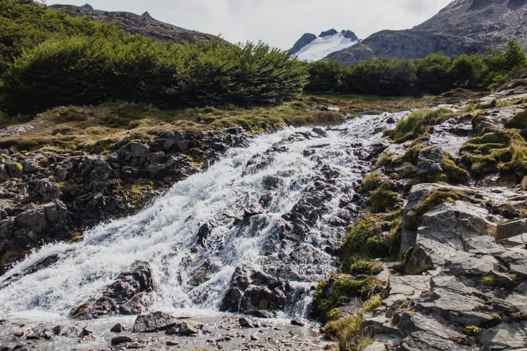
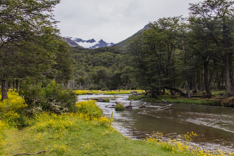
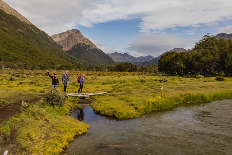
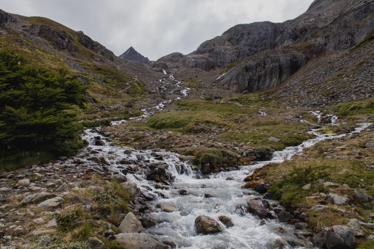
The trail is very well marked. The route takes you at the beginning to the beautiful valley full of yellow flowers in green meadows, you can enjoy the river views with the mountains in the background. While you cross the river, the trail starts to climb up through the forest.
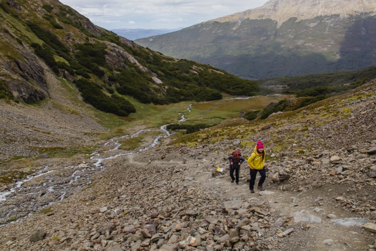
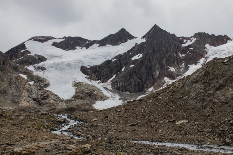
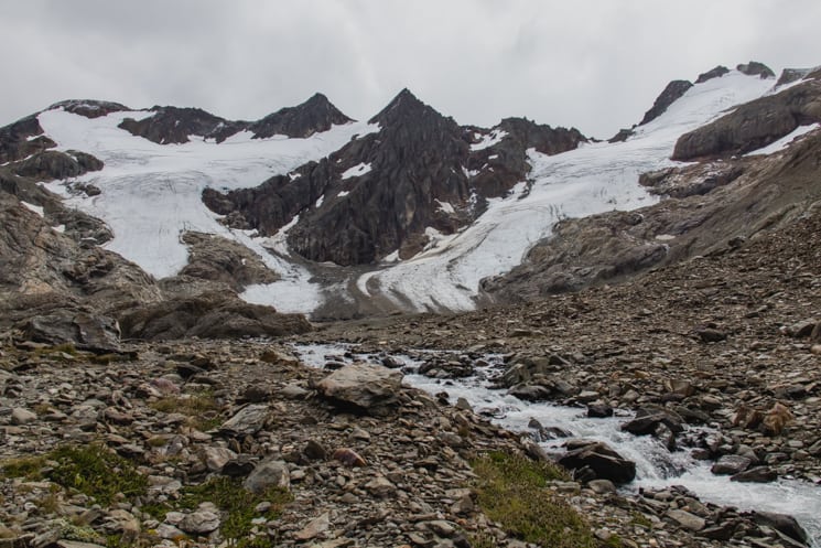
Some sections are quite steep and muddy, so be careful, especially after the rain, as the ground might be slippery. At about 550 – 580 meters above sea level, you will reach the clearing and come near the river. From there you will see the first views of the glacier.
The last section is the steepest and the most challenging. The hiking poles can do a lot. After this part of the trail, you will finally reach the lagoon. You don’t necessarily need to end your hike there, but you can continue all the way up to the glacier. Just be careful during very hot and sunny days. In those days, it might be safer to keep a distance from the glacier.
How to get to the Vinciguerra Glacier Hike trailhead?
There are no buses that go to the trailhead, so you can either come by car – there is a parking lot by the trailhead, or you can take a taxi (it’s a good idea to arrange also a pick-up time because it is bad to no mobile reception there).
Another option is to take the bus to the Valle de Andorra bus stop and walk from there to the trailhead (which is about an extra 3,8 km one way).
What to pack for the hike?
It’s always a good idea to pack some extra layers as the weather can be unpredictable. In general, we can recommend:
- Hiking poles
- Good hiking boots
- Layers of sports clothing
- Rainproof jacket
- Hat and gloves
- Water
- Sunscreen
- Sunglasses
- Snacks/lunch
- Outdoor offline maps (app)
Weather in Ushuaia in the upcoming days
The weather is really unpredictable due to strong winds. It might change suddenly from a completely sunny day to a snowstorm. So be prepared for everything.
You can check the weather for upcoming days here:
USHUAIA WEATHERRead about more hikes in Ushuaia
- Tierra del Fuego National Park – Best hikes and Things to Do
- Cerro Guanaco: Best Day Hike in Ushuaia (Practical Tips)
- Hiking to Laguna Esmeralda Without Guide (Practical Tips)
Where to stay in Ushuaia?
Accommodation
Accommodation in Ushuaia is pretty expensive. If you want to save money, you can go camping for free. Otherwise, choose these:
Budget: Casa de Familia – the cheapest good option. Very nice and clean accommodation. The disadvantage is that it’s not directly in the city center. It’s 20 minute walk or 10 minutes by bus.
Midrange: Rosa de Los Vientos: close to the city center and all the popular museums
Luxury: Cilene del Faro Suites & Spa – there is no better feeling than having a spa after a long hike or cruise. It’s also directly in the city center.
Camping
There are 2 free municipal campings.
- Municipal camping at Valle de Andorra
This is a nice campsite by the river Arroyo Grande with quite a lot of space for camping. There are nice dry toilets and water from the river is potable. This campsite is closer to the city center and bus stops.
- Municipal camping by the “Fin del Mundo” train station
The other campsite is a big flat area by the river Río Pipo. It is right in front of the “Fin del Mundo” Train station, and I would recommend staying there in case you plan to visit Tierra del Fuego National Park. The only problem is that the toilets are in the train station, which is closed during the night. There are also dry toilets, but it seems that nobody is taking care of them.
More pictures from the trek:
More tips for your travels:
We have prepared for you this comprehensive list of links, discounts, and resources for travel planning in one place. Bookmark this page and whenever you plan a vacation in the future, just open it and save yourself a lot of time.
1) Where to book accommodation?
- We prefer to find an accommodation using Booking.com.
- It's also worth it to compare with AirBnb.
- Read also our guide - How to search for the best accommodation.
2) How to find cheap flights?
- We recommend searching for flights on Skyscanner.
- Read also our complete guide - How to find cheap flights.
3) How to rent a car?
- We recommend a comparison portal RentalCars.com to compare the best offers of all available rental companies.
Pin this guide for later or for your friends:
Vinciguerra Glacier Trail Parameters
Vinciguerra Glacier Hike Description
Did this post help you? Share it with your friends! It can help them to